
Woodstock GIS Map
click to access the WOODSTOCK GIS MAP
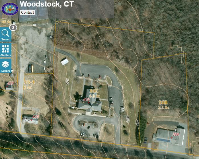
GIS stands for Geographic Information System.
Users can access geographic data that is stored in a database, and displayed on a map, or layers of a map. Users will be able to accomplish many tasks using a GIS, such as:
Locating properties to prepare Planning and Zoning or Conservation mailing lists
Reviewing aerial photos of the town
Reviewing property information for boundaries and zoning designations
Reviewing the location of state-designated soil-types
Getting Started
If this is your first time accessing our Town GIS, it is recommended that you navigate to the "help" link at the bottom left of the GIS viewer screen and click on "documentation. The link will open up an online PDF that explains every tool within the viewer. Please note that this site utilizes pop-up windows to print GIS Maps and other purposes. You must have pop-up blockers turned off or some features will not function. Please enable the pop-up windows (make them available) for this site only.
Disclaimer
The site you are linking to and the information on that site is a public resource of general information. The Town of Woodstock makes no warranty, representation or guaranty as to the content, sequence, accuracy, timeliness or completeness of any of the data provided on the site and the user should not rely on the data provided thereon.
The Town of Woodstock expressly disclaims any representations and warranties whatsoever and assumes no liability for any errors, omissions, or inaccuracies in the information provided regardless of how caused, or for any decision made or action taken or not taken by the user in reliance upon any information or data furnished on the site.